By Lucas Bissett
Louisiana: When it Comes to Land Ownership and Coastal Land Loss, it’s One of a Kind.
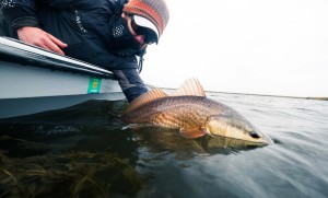
From a fly fisherman’s perspective, Louisiana stands out for its seemingly endless watery landscape, bountiful redfish population, and its mouth watering cuisine. On the surface, Coastal Louisiana it appears, has seen the creation of a balance between sportsmen and Mother Nature. Sportsmen have a vast expanse of coastline to use while Mother Nature provides a target-rich environment. Scratch just below the surface of this fairy tale facade and there exists epic battles that threaten the very fabric of what makes Louisiana the “Sportsmen’s Paradise”.
It’s not uncommon to read in the glossy pages of a fly fishing magazine that there are battles over public versus private land rights in streams and rivers out west, but it’s almost unheard of to see the same battle waging over salt water estuaries. Louisiana sees itself in the middle of such a battle over coastal waterways. Currently, a boater or fishermen could find themselves staring at a hefty fine for criminal trespassing or even run out of a bayou or marsh area at gunpoint. Louisiana land owners have the right to fence or gate off waterways that are tidally influenced. As of 2003, it is the fishermen’s responsibility to know what is private with or without posted signs. The real head scratcher is that most of the time these anglers used a “navigable waterway” by the federal definition to get into these fishing spots.
So, the question begs to be asked, how is this determined to be private property?
 Louisiana has never been comfortable following the status quo. Come to Louisiana and you won’t drive from county to county you’ll drive from parish to parish. Even the law code used is different from the rest of the country so it shouldn’t come as a surprise that when it comes to determining “navigable waterways,” Louisiana finds a unique solution there, too. A good portion of Louisiana’s coast is privately owned. Over the years, families and wealthy corporations have bought up any land on the coast that has come up for sale. Currently, Louisiana determines state owned “land” by using the map from 1812 when Louisiana became a state. When looking at a map from 1814 it becomes apparent that most of what seems to be navigable today was solid land then. In a world as technologically advanced as the one we currently live in, using such an archaic method to determine “navigable”, lends itself to an emotionally charged battle between land owners and anglers. Increasing the tension, is the fact that Louisiana is the only state where coastal waters that are influenced by the tide are determined to be private.
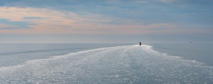
When looking at both sides of this argument, it’s easy to see why people are quick to raise their voices and sling vile words of defamation. One one hand, you have the land owners who worry about mineral rights, liability, and destruction of private property. On the other, you have anglers who believe using such an old map is completely ludicrous considering anyone who has spent time in the marsh realizes that the state has changed immensely since 1812. Areas that once consisted of solid land now have become a labyrinth of bayous and trenasses most of which are tidally influenced. While these arguments are viable on both sides, the bigger picture has to take into account the land loss that Louisiana is experiencing. Land owners and anglers can argue their points till they are blue in the face but the fact still remains if Louisiana doesn’t get its land loss under control, there won’t be any marsh to fight over.
Louisiana is losing a football field of land every hour.
 While those sorts of numbers are staggering and hard for people to wrap their heads around the fact still remains, Louisiana is sinking into the Gulf of Mexico. Anyone who has had the pleasure of coming to our marshes knows that it’s a fragile ecosystem teetering on the edge of collapse. The taming of the Mississippi River in the late 1800’s through levee systems has left Louisiana’s marshes starving for the sediment deposited by the river that created most of her coast. As the organic materials the marsh was created on rots, it sinks. And that, coupled with oil and gas exploration canals, has lead to a fraction of the coast being left compared to only 80 years ago.
So, how do these two extremely important subjects bring anglers and land owners together? As residents of one of the most productive ecosystems on the planet, we all have a responsibility to protect it. Anyone who is using or benefiting from our marshes should want to protect it so our kids have a place to learn about and create life memories the way we all did at their age. The irony of this situation is we are all arguing over land that is washing out from under our feet. We won’t have anything to argue over if we don’t address the more pressing issue of land loss. While the private versus public land battle doesn’t currently seem to have an end in sight, Mother Nature, with help from humans, will put an end to this battle whether we have made up our minds or not.
Want to learn more about coastal land loss, and maybe get involved?
Check out Anglers bettering Louisiana’s Estuaries
and Coalition to Restore Coastal Louisiana
Lucas Bissett Gink & Gasoline www.ginkandgasoline.com hookups@ginkandgasoline.com Sign Up For Our Weekly Newsletter!


Pingback: Louisiana’s famous marsh coast is sinking: rapidly – Fly Life Magazine
Thank you Lucas for explaining this issue. I’ve seen the No Trespassing signs myself. Was confusing to me. I don’t know the solution either but you are correct that Louisiana is losing so much. Keep up your efforts to save as much as you can.
Thanks to G&G and Lucas Bissett for the write up on our access issues.
It really hit the fan when surface drives came on the scene back in the early 2000s. In combination with airboat Swamptours. Land owners are tired of people invading their property and destroying the natural resources.